Pages

Monday, March 16, 2009

03-15-09 Mojave Road Part 2


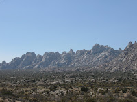
I awoke around 12:30 AM to what sounded like a dozen people doing the river dance in tap shoes about a foot above my head. The winds had picked up and with the gust of 40 plus MPH the whole tent was shaking. I glanced over at Jen and could tell from her look she was not to happy. My snoring has always made it hard for her to fall asleep. With the added slapping of the rain cover against the tent, sleeping seemed impossible for her. Both of us were wakened every 30 or so minutes through out the rest of the night. Finally, the sun came up and the winds slowly died off. When we had arrived at the Hole-in-the-wall camp site it was dusk. So upon exiting the tent we were greeted with a beautiful view of the surrounding mountains. The camp site gets it's name from the surrounding hills of rhyolite riddled with holes and small caves. After breakfast we checked out the Hole-in-the-wall information center and then headed out to get gas.


We headed down Essex Road toward I-40 to get gas in the small town of Fenner, Ca.. This gas station was located off I-40 on the historic Route 66. A couple of tall windmills and palm trees make it easily visible from the interstate. The gas station itself is quite unique, several drained fountains with interesting statues are located at the entrance. I can imagine this place was wonderful during the period Route 66 was the only highway around. Gas was a little expensive, being the only gas station around for miles.


After fueling up we got back on I-40 and headed west to the Kelbaker exit. This road would take us back into the Mojave Preserve. To the left rose the beautiful pale colored Granite Mountains covered in a light haze. As we rounded the bend and headed down into the valley, huge sand dunes became visible. The Kelso Dunes are nearly 700ft high and cover 45 square miles located in what is known as the Devil's Playground. These dunes were created by the prevailing winds and have been constantly changing for 25,000 years.

We stopped and checked out the Kelso Depot not to far up the road from the dunes. Located about 34 miles from Baker, Ca. off both the Kelso-Cima Road and the Kelbaker Road. Established in 1924, it served as a restaurant and train station on the Union Pacific railroad route from Salt Lake City, UT. to Los Angeles, Ca.. It now serves as visitor center and museum for the Mojave National Preserve. Inside, there are many informative exhibits describing the natural and cultural history of the preserve. There is an old telegraph station as well as a small gift shop and coffee house located in the depot.
Heading toward I-15 on the Kelso-Cima Road, we traveled into a large Joshua tree woodland. The remains of a couple old homes were located off to the side of the road. We stopped to let the dog's stretch their legs at Sunrise Rock while Jen and I took some photos. This area has the largest concentration of Joshua trees in the world. We stayed for awhile, taking in the huge white rock formations and the surrounding Joshua trees before heading back to Vegas.

03-14-09 Mojave Road Part 1


Saturday morning we headed south to the Arizona, California and Nevada borders. After 1 1/2 hours on the freeway, we turned off onto the Mojave road. We entered the Mojave road near the Colorado river, just north of Laughlin, Nv.. This 4x4 road runs the old Native American trail from the Colorado river into California near Barstow. It was once a main trading route for the Paiute, Mojave and Chemehuevi American Indians. Spanish explores traveled this trail, often guided by the Native Americans around 1770. With the increase of settlers moving west, the U.S. Army began to improve the road and set outposts along it during the 1860's. The road itself varies from graded to rough and soft sand. I recommend using a four wheel drive vehicle with high ground clearance. Bringing extra gas and plenty of water are also recommended. The road is very isolated and gas stations are few and far between.


Our first stop was Piute Springs. It is a lush wooded stream hidden in a mountain valley surrounded by desert vegetation. As we approached the spring, several rocks along the edge of the road contained petroglyphs. Some appeared to give directions or possibly a map to this oasis. Petroglyphs are a true passion for Jen, and she spent about an hour photographing and documenting them.


Just off the side of the road is the quite visible foot path of the original trail. Ten yards further up the road were the remains of an old ranch house in the wash. Some of the foundation, a fence and a concrete watering hole, has lasted through the ages. The desert was also much greener at this elevation .


We traveled about another 1/4 mile up into Piute springs and parked at the new kiosk. From the parking lot there is a panoramic view of the spring, Fort Piute and the vast valley. The ruins of Fort Piute are the 1st stop on the walking trail. The fort was established in the 1860's by the U.S. Army to protect the water of the springs as well being a mail post. Shortly after being established, the Army abandoned the fort. The railroad began to make it's way west around the 1890's and the Mojave Road became less used. The Mojave Road once passed through the springs, but now stops at the parking lot. It becomes a foot path for the next four miles. As you head down the trail be sure to look for petroglyphs that are scattered throughout the path on rocks and boulders. Cottonwood, pinyon, and juniper trees flourish along the banks of the stream. This spring is probably one of the most beautiful places I have explored in southern Nevada.


After exploring the spring for awhile, we headed back to the jeep and down the powerline road. We drove south to the detour around Piute Springs and headed into the Mojave National Preserve, via the Mojave Road. The Preserve is the third largest National park in the United States, outside of Alaska. It covers 1.6 million acres with elevations spanning from 800ft near Baker, Ca. to 7,929ft at the peak of Clark Mountain. The Mojave desert, Great Basin and Sonoran deserts all meet in this preserve. Landscapes vary from dry lake beds, desert, Joshua tree forests, sand dunes and woodlands. The Mojave Road makes it's way through the center of the preserve. Several paved roads also cut in and out with access from U.S. 95, I-15, I-40, Ca. route127, Nv. route164 as well as historic Route 66.

We set up camp at the Hole-in-the-wall camp site at 7pm. The sun had just set, we ate dinner and then gazed up at the stars. The stars were every where and shined very bright. Jen noticed a bright low moving light above us. We were pretty sure it was a satellite, but it seemed to bright. After returning home, Jen looked on the internet and is pretty sure it was the International Space Station. We then called it a night.