Pages

Wednesday, February 11, 2009

Mount Wilson Back Country Byway


For a little less brown and a lot more green, we headed to eastern Nevada to check out the Mount Wilson byway. This mountain is actually a volcanic caldera. It is a 66 mile dirt road winding high into the mountains near the Nevada and Utah border. In the lower elevations, pinyon and juniper pines line the sides of the narrow, goat trail like road. Higher elevations have aspen and ponderosa pines which create an almost Rocky Mountains feel. The weather was frequently rainy, which some how made it that much more beautiful. We also got to see a large group of elk which crossed our path a short distance away.


After the descent into the valley, we headed to Camp Valley. There were no signs of an actual camp, but this was once used by Native Americans. It was lush greenery with a good size creek that ran along the road. Beautiful pools developed here and there, making it's exploration a must.


As the road traveled through the valley, we passed old cabins and the Rice family cemetery. I really have no idea who the Rice family was, but would be quite interested in learning. Most of the tombstones are dated from the early to late 1800's. This is one of my favorite grave sites so far.


A few miles before the road became paved was the Eagle Valley Reservoir. The valley area was believed to have been occupied as far back as 5,500 BC and then settled by Mormons in 1864. Echo canyon was dammed up during 1969 and 1970 for flood control and water storage. Eagle Valley reservoir is a 64 acre state park, stocked with trout, several camp sites and very scenic.


Tuesday, February 10, 2009

Ghost town Rhyolite, Nv.


About 2hrs north of Las Vegas is the ghost town of Rhyolite,Nv.. It is inside Nevada on the California border near Death valley. Established in 1904 during the gold rush of 1904-1907, Rhyolite's population was once several thousand. In the financial panic of 1907, Rhyolite took a turn for the worse and people began to leave. In 1916 mining began to slow and the population decreased more with each year. By 1924 Rhyolite was deserted. Some buildings are still standing, others lay in ruins. This makes for a almost movie like depiction of a ghost town.


One of the more famous buildings is the Glass Bottle House. It is made from 10,000 bottles and completed in 1906. The house now serves as a visitor center of sorts, staffed by volunteers.


As you turn into Rhyolite off of highway 374, check out the Goldwell open air museum. It is off to the left of the road, you will not miss it. It definitely stands out in the desert surroundings. A remarkable display of outdoor sculptures.

Sunday, February 8, 2009

02-07-09 Is that rain????

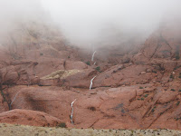
On Saturday a bizarre substance fell from the heavens. We desert folk would soon be told this was, rain. So I headed up to Red Rock Canyon. I was hoping get some shots of the water cascading down the cliffs.


Here is a couple of videos


Some photos


Off the scenic loop, I went through Willow Springs to Rocky Gap road. This road begins where the pavement ends. Two wheel drives used to make it through here but, with all the wash outs, I recommend four wheel drives only. I climbed in elevation to about 5000ft and found, snow!!!


02-02-09 Gold Butte


Sunday morning we headed out to Gold Butte, Nv. a back country byway. It is south of Mesquite,Nv. in the town of Riverside. The first 24 miles are paved (barely) and the next 19 or so miles are dirt. It is graded, but hold on to your seat and hope everything is secure. It is very bumpy, due to the washboard type road. A high clearance two or four wheel drive vehicle is recommended. A portion of the narrow, almost single lane, paved road runs next to the Virgin river. It winds up through hills and down across the flat desert floor. A view of Lake Mead is off to your right. As you approach the dirt section of road, you will notice the beautiful Whitney Pockets. This area is rich in spectacular red and yellow rock formations that are definitely a must see to visitors.


Be alert on this road. It is a popular OHV area and has a lot of quads and dirt bikes traveling along it. Always stay on the designated road, this place is abundant in historical sites. Most blend in with desert surroundings. Driving over them is destructive to it's features and to any future research. After about 7 miles, you will find Devils Throat off to the right. A 100ft wide by 100ft deep sink hole. It was once said to be bottomless or lead to a underground river.


Our goal in Gold Butte was to Locate some rock art Jen had once heard was here। Gold Butte road is a total of 62 miles through out the desert। Finding these were like locating the needle in a hay stack. As usual Jen was able to sniff them out. It was obvious that this was once inhabited by Native Indians. A perfect location from the river, with natural rock shelters. This would make for prime real estate in their day. We also discovered an amazing desert grotto, which we took video of.


We divided up, Jen took the high road and the dogs and I took the low. Sam, our male dog managed to find a couple of Doritos chips, literally in the middle of nowhere, I swear he thinks with his stomach. I found a couple more rock art panels. Jen came across similar art and wild horses. When we met back up, Jen took the dogs so I could climb into a shelter I had noticed earlier. So now I was stuck, unable to climb back down. Jen was trying to spot for me and I was not comfortable coming down facing out. After our argument of how rock climbers climb down cliffs (which I was pretty sure they never did, just up I thought), I managed to get down and look back up at what I had just conquered. Wow, moments ago, I was stuck way up there at a dizzying height of about 9ft. Don't laugh, it was "Extreme."


On a previous visit we stopped at the ghost town of Gold Butte. It was established in 1908 as a small copper, gold, lead, and zinc mining town. It even had it's own post office. Arthur Coleman and William Garrett were the last two residents. They died in 1958 and 1961and are buried here. Cement foundations, mining equipment, and the remains of old mills still exist.


After Gold Butte we followed the road to Cat Claw wash. It ends at Lake Mead, on the opposite side of Overton, Nv.. A beautiful view and not a soul around, being a good 30miles from the nearest paved road. We enjoyed our own beach and the dogs loved the water.